The Map shows what's happening around your unit right now: other patrols and guard units, officer units, radios, today's rescues and open incidents. It's found under Map in the left-hand menu once you've opened your patrol unit.
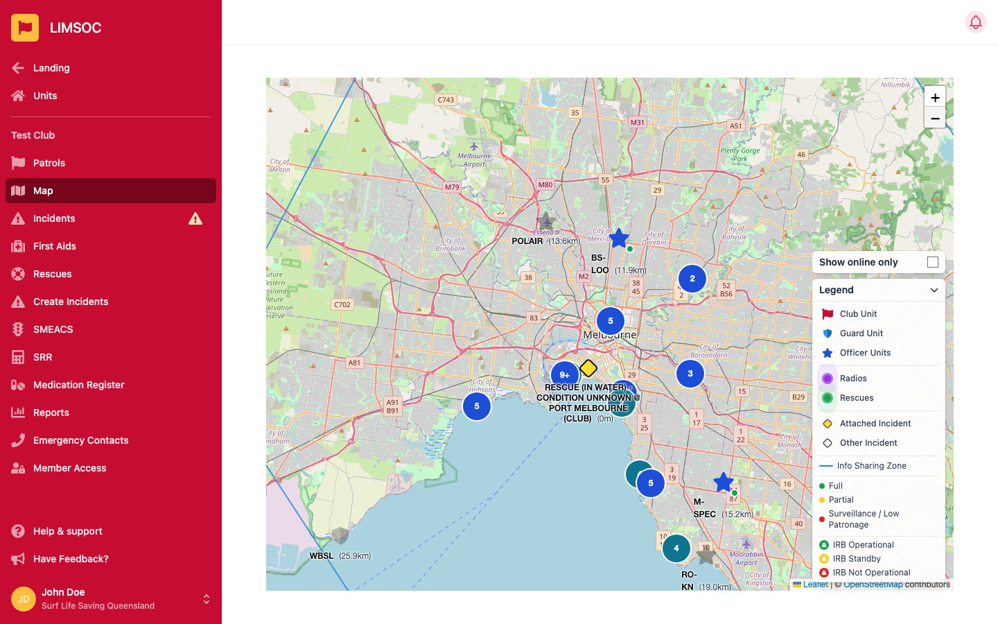
The map opens centred on your unit. Zoom with the + / – buttons in the top-right, or pinch on a phone or tablet. Scroll-wheel zoom is turned off so you don't zoom by accident while scrolling the page.
If your browser allows location access, a blue dot labelled Your location shows where your device is. Each marker's label also shows its distance from your unit, e.g. (350m) or (1.2km).
The Legend in the bottom-right explains every marker. Tap its heading to collapse or expand it.
Club Unit (red flag), Guard Unit and Officer Units (blue star). Other unit types use their own icon.
Radios (pulsing purple dot): only radios that have reported in today.
Rescues (pulsing green dot): today's rescues only.
Attached Incident: an open incident your unit is attached to. Other Incident: an open incident nearby that your unit isn't attached to, shown with limited detail.
Patrol strength dot on each unit: green Full, yellow Partial, red Surveillance / Low Patronage.
IRB status boat badge on each unit: green IRB Operational, yellow IRB Standby, red IRB Not Operational.
Zones: Info Sharing Zone (blue outline), Primary Patrol Zone (solid orange) and Secondary Patrol Zone (dashed purple). These only appear if they've been set up for your unit.
Signed-off units and officers are drawn faded and grey. Officer stars also carry a small dot: green when signed on, grey when signed off. Where lots of units, officers or radios are close together they're grouped into a numbered circle. Click it to spread them out.
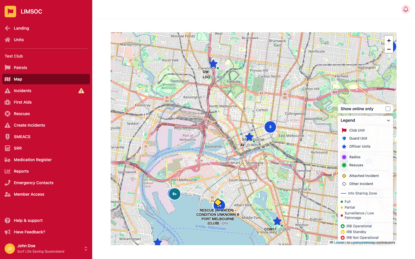
Tick Show online only (above the legend) to hide signed-off units and officers. Radios, rescues and incidents aren't affected.
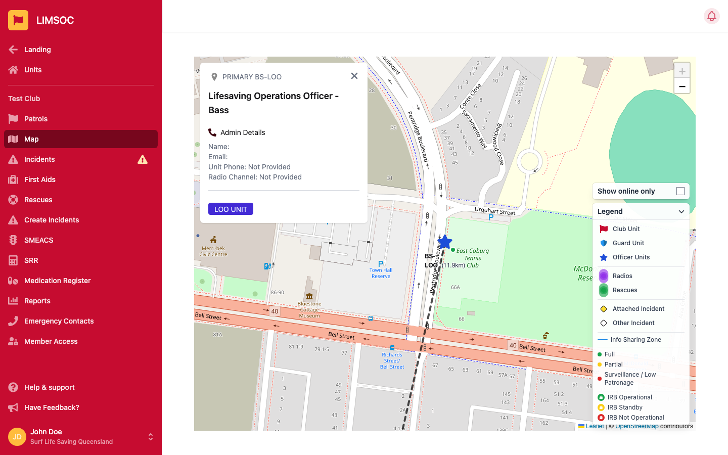
Clicking a marker zooms to it, draws a dashed line from your unit, and opens a details card in the top-left. Close it with the X.
Units and officers show their callsign, Admin Details (name, email, unit phone and radio channel), and their current patrol strength and IRB status, with reasons where given.
Rescues show the location, patient age, distance out, method, patient condition, who performed it, any linked incident, notes and the time.
Incidents show the incident number, when it was created, the number of people and the primary service. If your unit is attached, you'll also see the location and further information, plus an Open incident log button that takes you straight to the incident's logs.
Radios don't have a card. Clicking one just zooms to it.
The map only shows things inside your unit's information-sharing zone. The exception is incidents your unit is attached to, which always show. If you see no other units at all, your unit may not have a zone set up. Contact your administrator.
Your organisation decides which kinds of information are shared on the map. If a whole category (e.g. radios) is missing from the legend, it's been turned off.
Rescues and radios reset each day, and closed incidents drop off the map.
Check that Show online only isn't ticked.
If a yellow Reconnecting... badge shows in the top-right, you've lost connection and the map will catch up when you're back online.
If there's no Map item in your menu at all, the map isn't enabled for your organisation.